Pennsylvania is home to more than 200 Covered Bridges. Due to their scenic locations, these historic structures make for excellent destination points for Solo and Group Motorcycle Rides. I recently visited the Red Run Covered Bridge and found the trip enjoyable.
The Red Run Covered Bridge (Also known as Oberholtzer’s Mill Covered Bridge) is a privately owned covered bridge located at the Red Run Campground in Denver, PA. The bridge was constructed in 1866 but is no longer open to traffic. It can be observed from Martin Church Rd.
Please read on if you want to learn more about the Red Run Covered Bridge or Recreate my Motorcycle Destination Ride.
Ride to Red Run Covered Bridge
Every Motorcycle Destination Ride needs a starting point. For me, that point is Martin Moto in Boyertown, PA. This is my hometown Dealership and is a convenient starting point when discussing destination rides. If you choose to go on this ride, you can easily change the starting point to a more convenient location.
When given the opportunity, I avoid using Google Maps for Motorcycle Rides. It is an excellent tool for getting from Point A to Point B, but it can be challenging to utilize it in a way that allows you to take in the joys of backcountry roads. For this reason, I often use Calimoto or Rever.
Route Map
Below is a snapshot of my ride from Martin Moto to Red Run Covered Bridge Ride. It covers 43 Miles (One Way) and will take approximately an hour and ten minutes to complete. In the event that you need a rest stop, you’ll be riding past the Daniel Boone Homestead. It is a great place to stop and look around, but the restrooms are often locked.
For fuel or bathrooms, there are two easily accessible gas stations just over the bridge in Birdsboro. The remainder of the ride is rather rural, and there will not be any convenient places to stop without leaving the route.
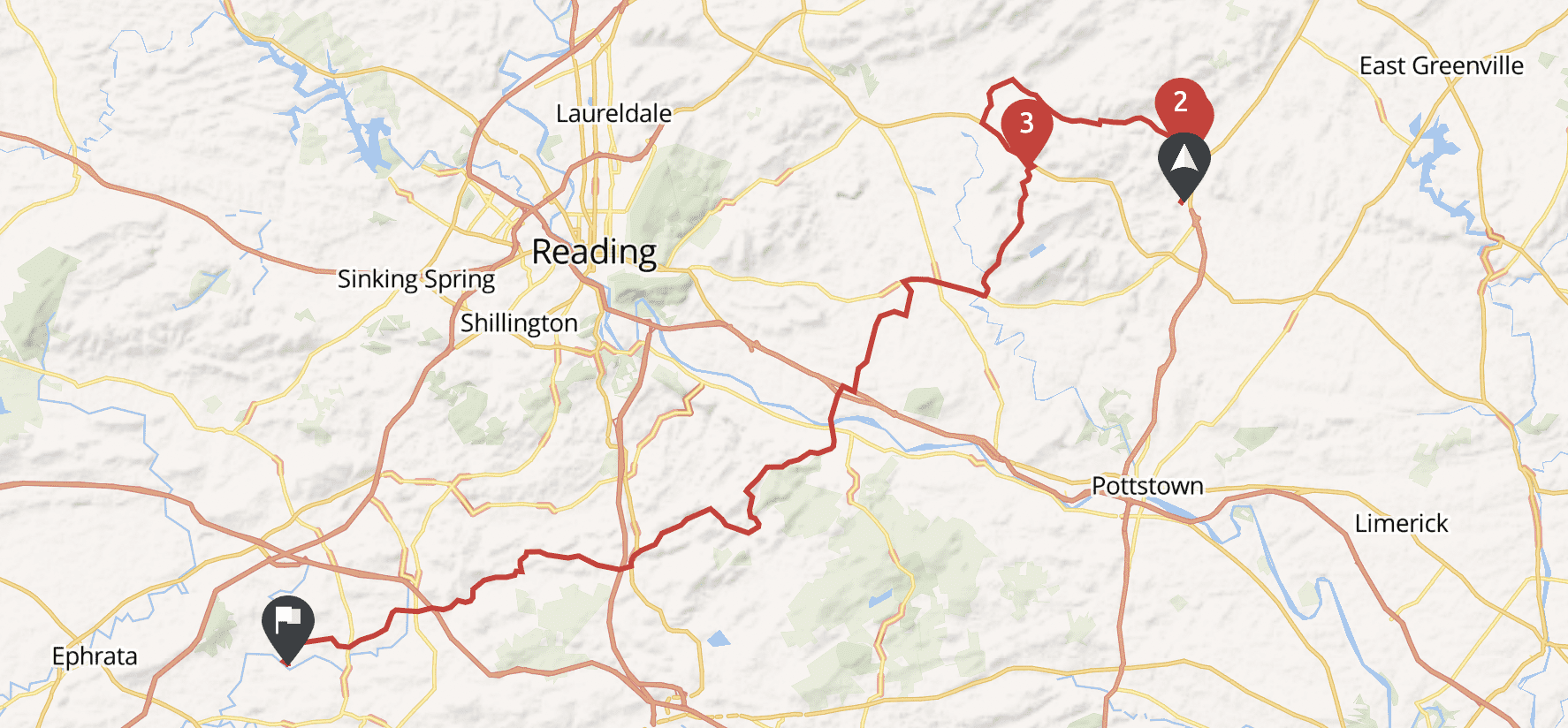
Boyertown to Douglassville
You may wonder why we start our journey heading north instead of a more direct southwest. The reason for this is simple – traveling a couple of miles north allows us to ride through the treelined hills of the Boyertown / Bechtelsville area. The sights and curvy roads are well worth the slight detour.
One potential trouble spot with this route is that it comprises rural backcountry roads – most of which are Tar & Chip. This in and of itself isn’t a problem; the problem arises if PENNDOT Trucks come out to perform maintenance. Keep an eye out for Fresh Oil and Chip Signs.
Douglassville to Birdsboro
Going from the Douglassville area to Birdsboro is a straightforward route without many twists and turns. This way was planned to give you a break from the backcountry roads and travel past a convenient rest stop in the Daniel Boone Homestead.
When planning motorcycle routes, I do my best to avoid highways. In this case, It was unavoidable. You’ll be traveling on PA Rt 422 West for less than a mile before turning off and making your way into downtown Birdsboro. Be prepared for some traffic congestion as this is the main thoroughfare in and out of town.
Birdsboro to Denver
After riding through downtown Birdsboro, you’ll pass Browns Feed Mill and turn onto Cocalico Rd. This is my favorite portion of the ride. There are plenty of curves through beautiful treelined backcountry roads. As you progress into Lancaster County, you may see Horse & Buggies riding around the Memmonite and Amish communities.
When passing horse-drawn buggies, do so with care so as not to spook the horses.
Parking at The Red Run Covered Bridge
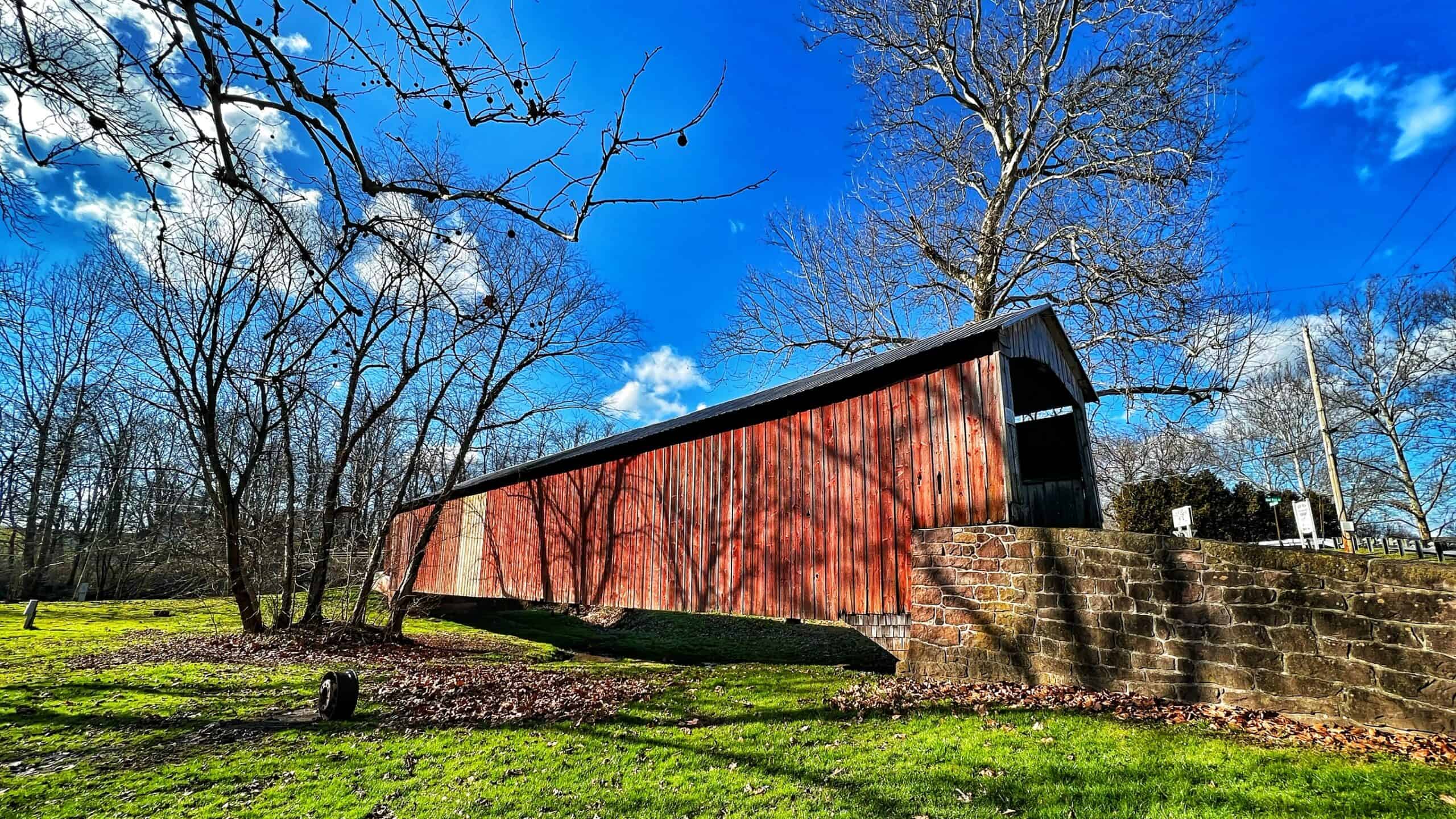
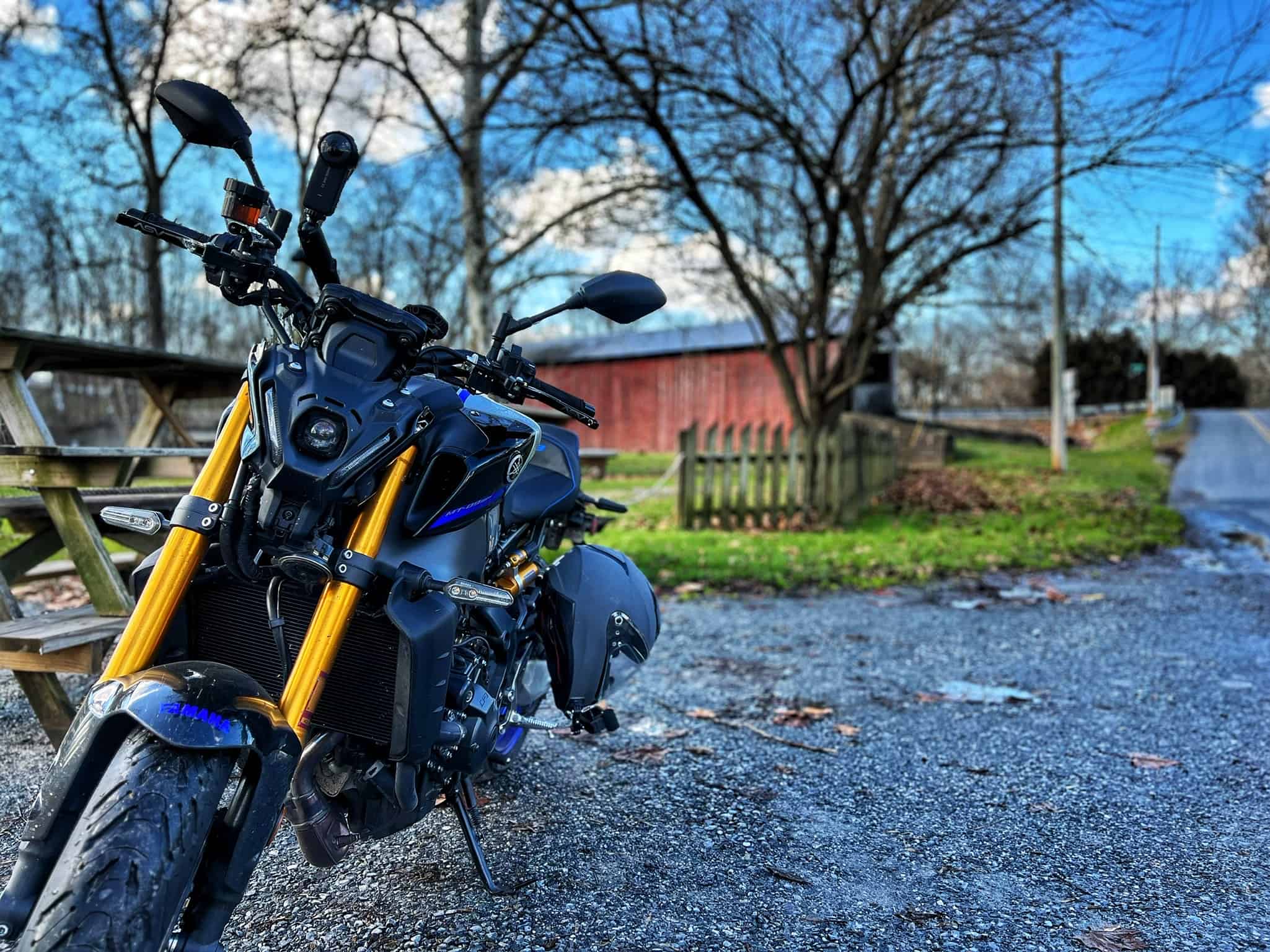
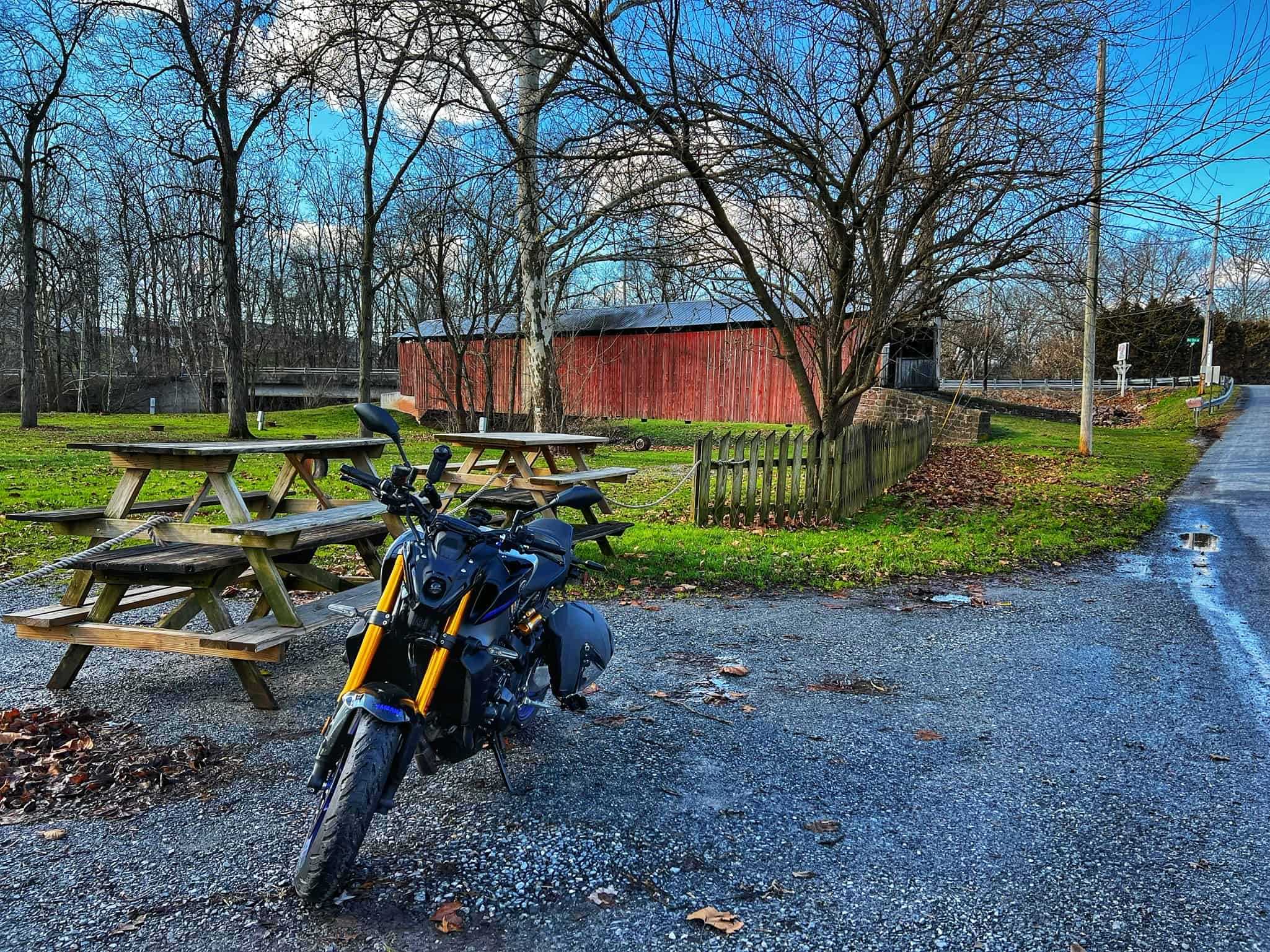
The Red Run Covered Bridge would make for an excellent stop along a Motorcycle Group Ride. There is no parking at the bridge itself (which makes getting photos of your Motorcycle and the Covered Bridge a challenge), but there is ample space to park in the Campground Lot across the street.
During my visit, I could park at one of the campground entrances, which was blocked off due to being off-season. The bridge approach consisted mostly of grass and was rather soft from recent rain. I would not advise attempting a Bike and Bridge Photo unless the ground was dry enough that your kickstand would not sink into the earth.
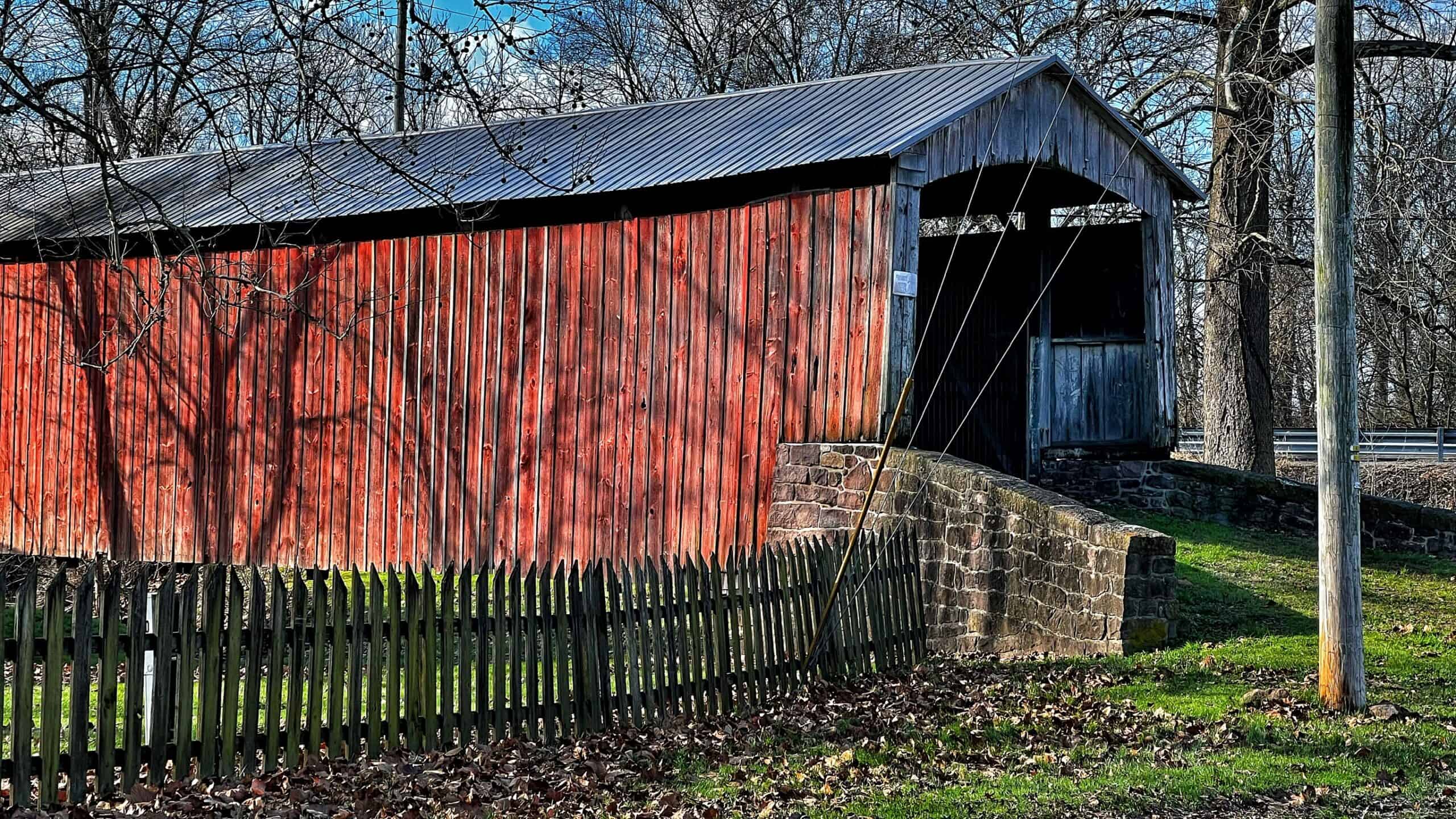
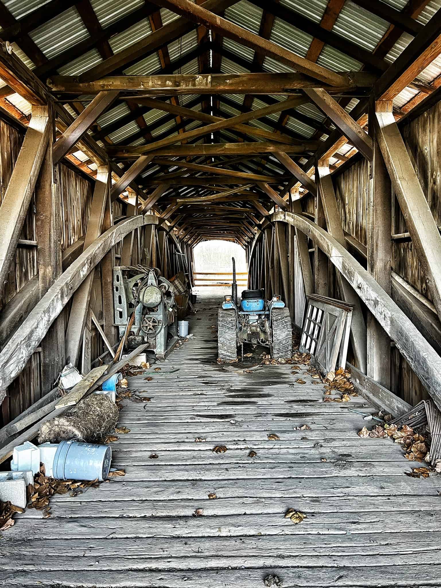
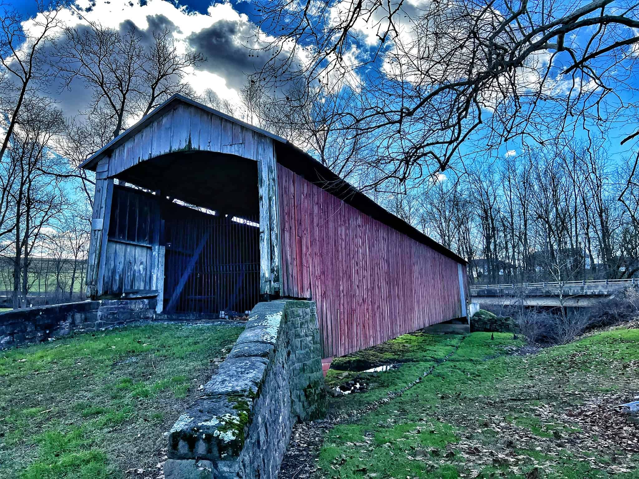
Red Run Covered Bridge Photos
Red Run Covered Bridge History
The Red Run Covered Bridge (Also known as Oberholtzer’s Mill Covered Bridge) was constructed in 1866 by acclaimed bridge builder Elias McMellen. The bridge initially crossed Muddy Creek and spanned 107 feet in length. The covered bridge features a double Burr Arch Truss design, popular among Covered Bridges in Pennsylvania.
If you were to visit the Red Run Covered Bridge today, you might suspect that it was moved away from the Muddy Creek to be preserved – much like the South Perkasie Covered Bridge was moved and preserved. However, in 1961 a modern concrete bridge was built to replace it. The creek was then diverted around the Red Run Covered Bridge to the modern replacement.
Red Run Covered Bridge was designed to match the typical Lancaster County aesthetic with Red Walls and a White Approach. The same color pattern is used today; however, the bridge is badly worn. The bridge is no longer open to traffic and resides on Private Property at Red Run Campground. Sadly, it appears as if its primary function is to serve as a storage unit.
Elias McMellen
Captain Elias McMellen was a bridge-maker and Captain in the Union Army who had a distinguished career during the Civil War. He enlisted for service in Company K, 79th P. V.I., before contracting camp fever at Perryville and being sent home on furlough. He later rejoined the army as first lieutenant of Company C, 21st Pennsylvania Cavalry. He was later appointed Captain of the regiment’s Color Company.
McMellen went on to build some of the most famous covered bridges in Pennsylvania, with his reputation as a bridge builder being second to none in eastern Pennsylvania. Quality was always an important factor for him when building these bridges; he put great care into each one, ensuring that it met high standards before completion. His work helped shape Lancaster County and beyond, as many iron, wooden, and stone bridges were erected throughout this area due to his expertise and dedication to quality craftsmanship.
Covered Bridges By Elias McMellen
| Bridge Name | Year Built | Link |
|---|---|---|
| Pool Forge Covered Bridge | 1859 | Open in Google Maps |
| Red Run Covered Bridge | 1866 | Open in Google Maps |
| Pinetown Bushong’s Mill Covered Bridge | 1867 | Open in Google Maps |
| Forry’s Mill Covered Bridge | 1869 | Open in Google Maps |
| Lime Valley Covered Bridge | 1871 | Open in Google Maps |
| Miller’s Farm Covered Bridge * | 1871 | Open in Google Maps |
| Risser’s Mill Covered Bridge | 1872 | Destroyed By Fire |
| Landis Mill Covered Bridge | 1873 | Open in Google Maps |
| Kauffman’s Distillery Covered Bridge | 1874 | Open in Google Maps |
| Bucher’s Mill Covered Bridge | 1881 | Open in Google Maps |
| Pine Grove Covered Bridge | 1884 | Open in Google Maps |
| Keller’s Mill Covered Bridge | 1891 | Open in Google Maps |
* The Miller’s Farm Covered Bridge was to be demolished in 1962. To preserve the historical landmark, the County of Lancaster gave the bridge to Mr. Adolph Neuber (Owner of The Willows Restaurant). Mr. Neuber then purchased the Good’s Ford Covered Bridge, also set to be demolished in 1962. With the help of Roy Zimmerman, the remains of both bridges were salvaged to create The Willows Covered Bridge in 1962.
Recent Posts
I Unsubscribed from Bikes and Beards. Then They Pulled Me Back In.
Monday morning commute. Motorcycle in the garage, rain in the forecast for the rest of the week, so I'm getting miles in while I can. And somewhere between pulling out of the driveway and hitting the...
Visiting the Reading Pagoda in 2026: A Moto Vlog Update from Mount Penn
If you have been riding in Pennsylvania for any amount of time, there is a good chance the Reading Pagoda has been on your list at least once. It sits up on top of Mount Penn overlooking the city of...